Hello,
I’m here again to ask you for help.
From Win10 I am using the command line and the otbgui, in particular the Application otbgui_Orthorectification (of a Worldview2 scene already superimposed: 42 gigabytes!).
When I set the input image I see that in the cmd line appears:
2020-02-03 09:04:48 (INFO): Loading kwl metadata from attached geom file F:/Pansharpened_bayiesian.geom
Then, due to the fact that my image is OrthoReady, I add to the input image name “?&skicarto=true” like this:
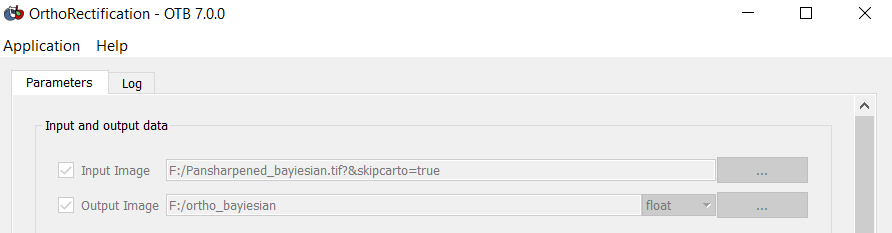
And immediately in the cmd line appears for a second time the same string as you can see here, so it look like:
2020-02-03 09:04:48 (INFO): Loading kwl metadata from attached geom file F:/Pansharpened_bayiesian.geom
2020-02-03 09:06:30 (INFO): Loading kwl metadata from attached geom file F:/Pansharpened_bayiesian.geom
So I suppose that the Orthorectification Application has successfully received the command, isn’t it? (I think the notebook will work for at least one day)
I used aster dem (2 file tif in the same folder in the same projection of the image: WGS84 UTM 32 N) and the geoid “egm96.grd”.
Tomorrow I will try with a dem with higher resolution, I would like to ask you if in this way the extended namefile “?&skipcarto=true” is it taken into account in the process?
It is correct to use the geoid “egm96.grd” in this case?
I read that the geoid is to be used depending on the reference of the elevation, what it is the meaning? I am using all raster projected in WGS84 UTM 32 N (epsg 32632)
Thank you very much in advance,
here below the other settings in the gui:
Map Projection: UTM, zone number 32
Northern Hemisphere: On
Bicubic interpolation, radius 2
Available RAM 3500 MB
Resampling grid spacing 1.6