Hi at all,
I’m just starting my dive inside the OTB’s world. Seems really interesting.
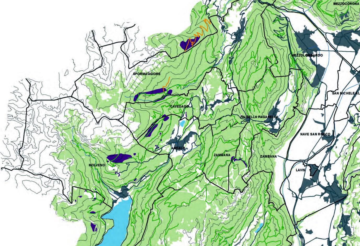
Well, I’m interested in understanding if and how OTB (Monteverdi) may help me in doing thematic maps (like the ones in attach
) classification because I’ve got a lot of these datasets (georeferenced) I wish to recover the more info from them.
For examples, in reference to the attached image, my target are the purple polygons.
But, sure due to my big ignorance, I can’t find a way to move from the raster to a vector containing just the purple area polygonized.
Segmentation (both as vectors or raster outputs) works quite well, but how I can extract polygons from the purple areas? What’s process chain you may suggest in order to achieve targets of this type?
TIA
Best
fz
Hi,
What you can do is use the vector mode of the Segmentation application. In this mode you can provide a mask. The mask should mask every thing but the purple area (you can generate it with the BandMath application). Then only the purple area will be processed and you will have in output a vector containing the different polygon representing the area you are interested in.
Here is the Segmentation application documentation: https://www.orfeo-toolbox.org/CookBook/Applications/app_Segmentation.html. Have a look at Processing mode : Tile-based large-scale segmentation with vector output.
And here is the BandMath application documentation: https://www.orfeo-toolbox.org/CookBook/Applications/app_BandMath.html. Remember that in a mask negative value are pixel that will be masked. So you need to provide a test in exp field that correspond to what you want to mask and what you want to segment. Eventually if it is to complicated you can still use the Segmentation application to get a labeled image where you can identify what is the label corresponding to your class and then use BandMath to make the mask.
I hope it will work,