Dear all,
Let me start with the statement that I have really enjoyed working with orfeo toolbox so far and that I am looking forward to OTB 7.0  .
.
After some work, I am experiencing some issues where I didnt find a solution for. I am experiencing two shifts when performing the extractROI and pansharpening method of a Pleiades multispectral and panchromatic image.
Firstly, my shift is when i call the command for ExtractROI.
otbcli_ExtractROI -in IMG_PHR1B_P_201809081033410_SEN_3298159101-1_R1C1.JP2 -out roi_p.tif float -mode extent -mode.extent.ulx $min_lat -mode.extent.uly $max_lon -mode.extent.lrx $max_lat -mode.extent.lry $min_lon -mode.extent.unit lonlat -cl Channel1 -ram 24000
and
otbcli_ExtractROI -in /IMG_PHR1B_MS_201809081033410_SEN_3298159101-2_R1C1.JP2 -out /roi_ms.tif float -mode extent -mode.extent.ulx $min_lat -mode.extent.uly $max_lon -mode.extent.lrx $max_lat -mode.extent.lry $min_lon -mode.extent.unit lonlat -cl Channel1 Channel2 Channel3 Channel4 -ram 24000
I retrieve the longitude and latitude from a geojson file where i select the maximum longitude and the maximum latitude.
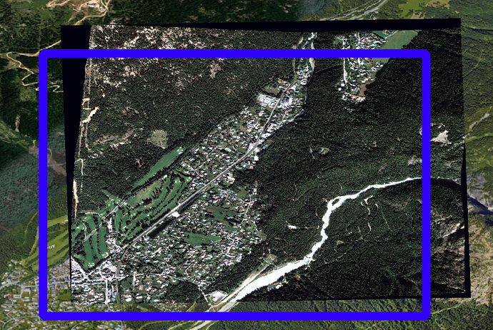
However, when comparing the expected area on google earth from the geojson with the result of the extractROI a different area is observed. I assume this is because of the RPC file of the pleiades images being less exact then the google earth image? If this is the case, I was wondering if there is a way to extract the correct area from a vector area selected on google earth / another area and then perform the extractROI on the longitudes and latitudes retrieved from the corners of this area? Or do you have another explanation for this shift?
After orthorectification, the resulting shift in the pansharpened image with the geojson selected is observed in this image: This shift is accountable for a ± 200 meter north east difference between google earth and the pansharpened image.
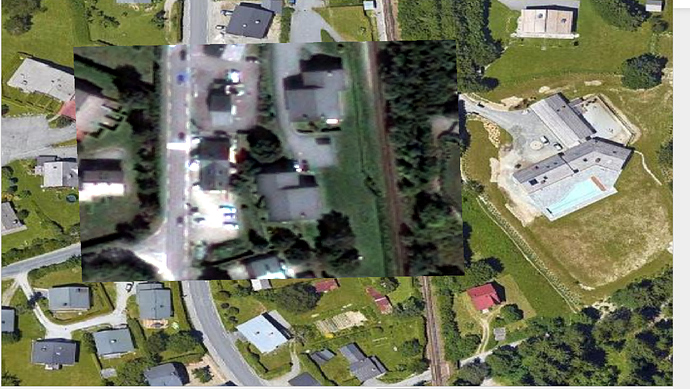
Secondly, when comparing the result of the orthorectified pansharpened image and the google earth image, I noticed an overall distortion of 2 - 4 meter, also in north east direction. Im using the ASTER DEM for the orthorectification in this area.
I’m not sure if this is an acceptable result after orthorectification of a pleiades pansharpened image? I perform the orthorectification with:
otbcli_OrthoRectification -io.in cal_roi_p.tif -io.out cal_orth_roi_p.tif float -outputs.mode outputroi -elev.dem /dem/ -elev.geoid /egm96.grd -opt.ram 24000
This shift is visible in this image:
I hope my two issues are clear, and that this is the right forum to ask these questions.
If not, please point me in the right direction.
Looking forward to your support!
Regards,
Thijs

